
SENTINELA
Pioneiro na prevenção de deslizamentos


O DESAFIO
O Sentinela foi desenvolvido para transformar a maneira como a Defesa Civil de Minas Gerais avalia riscos de encostas e previne desastres naturais. Por meio deste aplicativo, conseguimos integrar tecnologias inovadoras que auxiliam no monitoramento contínuo de áreas vulneráveis em todo o estado, permitindo uma resposta rápida e eficaz diante de situações adversas.
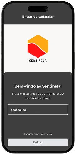
Nossa missão é contribuir para a segurança das comunidades mineiras, tornando o processo de avaliação mais acessível e eficiente com um sistema intuitivo e ferramentas especializadas de geolocalização e captura de imagens em tempo real.

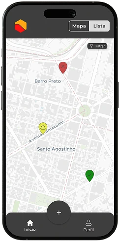
GEOLOCALIZAÇÃO PRECISA
Captura localização exata de encostas vulneráveis com GPS de alta precisão, mapeando áreas críticas em tempo real para agilizar deslocamento das equipes de resposta.

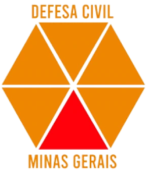
CAPTURA INSTANTÂNEA
Fotos e vídeos em tempo real documentam condições de risco imediatamente, criando histórico visual completo para análise técnica e relatórios oficiais de emergência.

ALERTAS INTELIGENTES
Notificações push instantâneas para equipes quando anomalias são detectadas, garantindo resposta rápida mesmo em áreas remotas ou condições climáticas adversas.

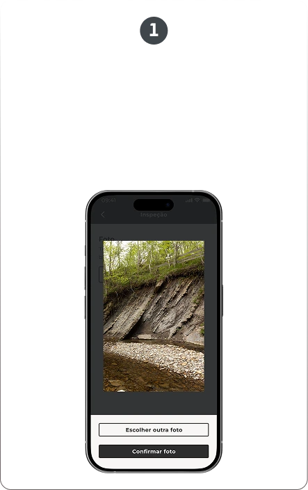
ANÁLISE AUTOMATIZADA
IA avalia imagens e dados geográficos para classificar gravidade do risco, priorizar intervenções e sugerir ações preventivas baseadas em padrões históricos.
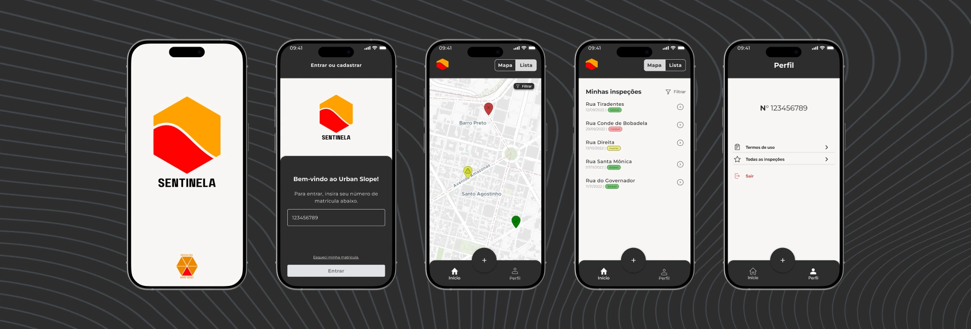
IMAGINANDO AS TELAS

PRECISÃO
EFICIÊNCIA

ACESSIBILIDADE
Para o Sentinela, a precisão é fundamental, já que o aplicativo deve fornecer dados confiáveis sobre o risco de encostas para a Defesa Civil. Por isso, as telas foram desenhadas para garantir que a informação seja exibida de forma clara, precisa e eficiente, com mapas e gráficos fáceis de interpretar. A acessibilidade também foi priorizada, permitindo que diferentes usuários, incluindo aqueles com pouca familiaridade com tecnologia, possam navegar com facilidade.
Guia de estilos
Cinza grafite
#2E2D2D
FONTE PRINCIPAL
Montserrat
Letras:
Aa Bb Cc
Números:
012345
CONSTRUINDO O PROJETO
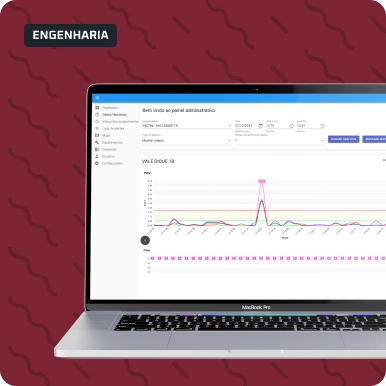
O desenvolvimento foi orientado para garantir que os dados de risco de encostas fossem processados e apresentados de maneira eficiente. A plataforma foi criada para lidar com grandes volumes de dados em tempo real, proporcionando um sistema ágil e seguro para monitoramento e análise geoespacial.
figma
flutter
firebase
A criação das interfaces do Sentinela começou no Figma, onde desenvolvemos protótipos visuais que refletissem a simplicidade e eficiência necessárias para uso em campo. Com o Figma, pudemos mapear toda a jornada do usuário, criar fluxos intuitivos e validar visualmente cada elemento da interface, garantindo um design coeso e focado na experiência do usuário.
A IMPORTÂNCIA POR TRÁS DO SENTINELA
O Sentinela utiliza modelos estatísticos e algoritmos de aprendizado de máquina para classificar a estabilidade de encostas urbanas com base em dados coletados em campo. Cada inspeção transforma medições técnicas em uma análise objetiva de risco. Desenvolvido para apoiar as equipes da Defesa Civil do Estado de Minas Gerais, o Sentinela contribui para a mitigação de riscos em áreas urbanas vulneráveis, fortalecendo a atuação preventiva do poder público.
DIFERENCIAIS

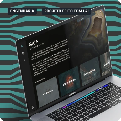
INTELIGÊNCIA ARTIFICIAL APLICADA
Modelos de Regressão Linear e Estatística Multivariada transformam variáveis de campo em uma classificação objetiva de risco.

ANÁLISE OFFLINE
Funciona completamente offline em áreas remotas. A sincronização ocorre automaticamente quando há conexão disponível.

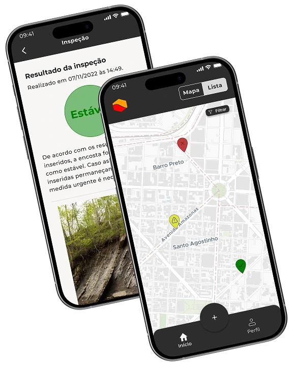
MONITORAMENTO GEORREFERENCIADO
Visualização em mapa das áreas inspecionadas, permitindo rastreabilidade e acompanhamento contínuo das encostas monitoradas.

PLATAFORMA MODULAR E ESCALÁVEL
Arquitetura adaptável a diferentes contextos com possibilidade de criação de novos módulos especializados.
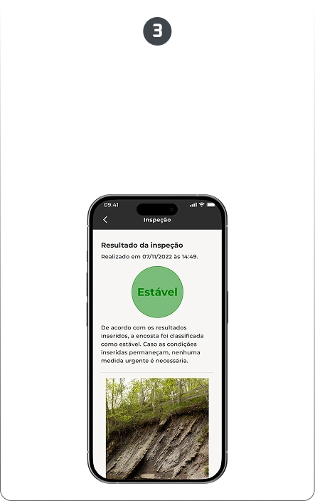
COMO O SENTINELA TRANSFORMA MEDIÇÕES EM DECISÃO
O RESULTADO
Combinando geolocalização precisa, análise por IA e interface intuitiva para campo, transformamos o Sentinela na referência oficial da Defesa Civil MG para prevenção de desastres. Cada funcionalidade foi desenhada para salvar vidas, com reconhecimento pioneiro em monitoramento de encostas urbanas.